

Old landscape drawings and panoramas of the city can be mesmerizing, in addition to being information-rich artifacts of the past. In a time when we record more data about the city in an hour than we did for the first 300 years of history, these images only become more important with time.
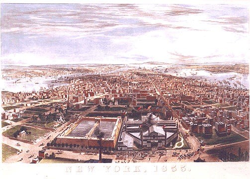
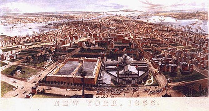
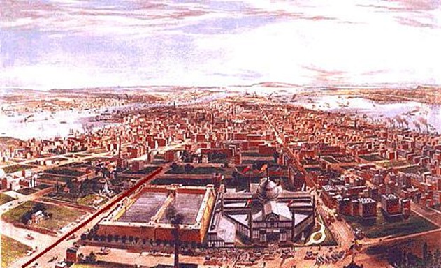
This post takes two old panoramas and puts them together, creating a super-view of the mid-19th century city. They are only three years apart in the late 1850s and show two halves of the city, from Central Park all the way to the Battery.
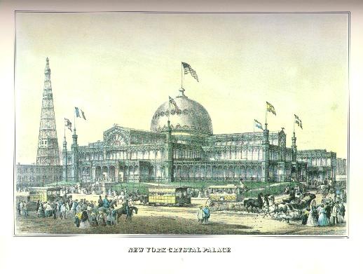
A single building can be seen in both images, the Crystal Palace.
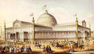
The Crystal Palace stood where Bryant Park is today. The monumental glass and cast-iron structure was supposedly fireproof. According to the Encyclopedia of New York City, “[it] opened on 14 July 1853 as the site of the first world’s fair in the United States, an event entitled, ‘Exhibition of the Industry of All Nations,’…. [The fair] exhibited the products of agriculture and industry, and housed a collection of sculpture; it was also the first world’s fair to exhibit paintings in a picture gallery.” The list of inventions at the height of technology is pretty interesting. Gotham says,
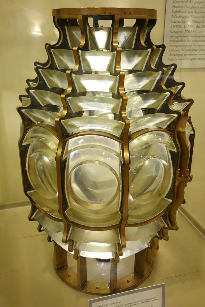
Crowds roamed the building’s halls past shimmering fountains and glaring clusters of gas lights, marveling at the miracles of the age, great and small: scales, meters, guns, lamps, safes, clocks, carriages scientific instruments, agricultural instruments, a Fresnel lighthouse lens, telegraphy and photography equipment, fire engines, ships and plans for an elevated railroad above Broadway [built about 30 years later]. And machinery, everywhere machinery—machinery to pump water, sew, print, finish wood, refine sugar, set type, make ice cream, and wash gold.
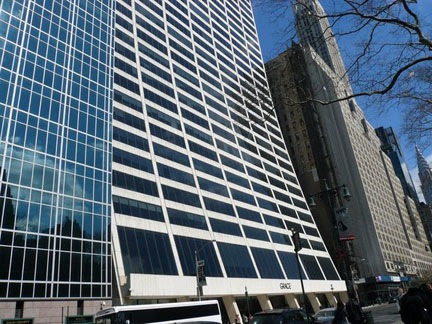
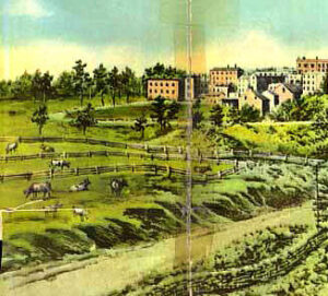
Here’s the site today from about the same perspective, near the corner of 40th Street and 6th Avenue, Bryant Park. The WR Grace Building is where the Latting Observatory stood.
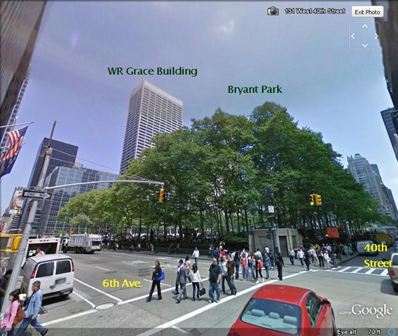
If you don’t know the WR Grace building (Bunshaft, 1974), it’s one of the most recognizable buildings in the city. A little originality goes a long way on 42nd Street.
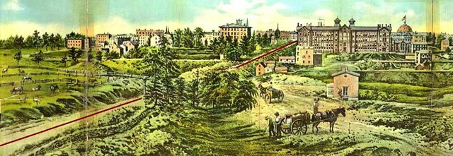
The Latting Observatory demonstrated Elisha Otis’s new safety elevator. But it only rose two floors and guests had to climb the tower to take in the view, which someone did to make our first image.
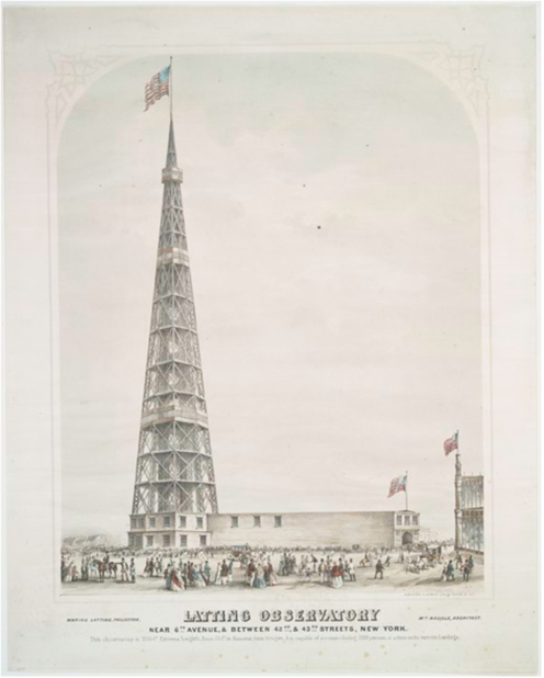
From the Latting observatory the artist was able to capture a sweeping view. The Croton Aqueduct Distributing Reservoir (the NYPL today) is left of the Crystal Palace. In this image there are people walking along the walls of the reservoir; it was a favorite activity of Edgar Allen Poe.
The East River and Long Island are to the left (Brooklyn and Queens are not yet part of New York City), and the Hudson River and New Jersey are to the right. What’s striking is how clear it shows the city was growing from the outside, from the shoreline, in. Fifth Avenue (coming out of the bottom left corner) is relatively undeveloped compared to other avenues. In fact, bands of activity belted the island—the waterfront was active with shipping, while factories and warehouses just in from the shore, and nearby the factories were tenements for the working class. The horsecar lines of the 1850s, especially along 9th Avenue, brought development. The island’s interior was left in relative quietude. The wealthy elite, who had been on Fifth Avenue since the 1830s, would march though this spot on Fifth Avenue in a phalanx of brownstones in the coming decades.
Here are the two images side-by-side (top-to-bottom). A line is painted down Fifth Avenue to connect them. Together, they’ll give you a good sense of the city’s uptown growth in the late 1850s, just before the Civil War.
You can almost pinpoint the uptown growth in 1858, somewhere around the mid-50s. Some of today’s most expensive real estate was cow pasture in 1858. The buildings almost seem to be eying the cows.
Really interesting, loved this read!
Really Interesting, i would like to see a map of how New York City expanded over time, like when it expanded to mid and uptown Manhattan.
Fascinating stuff – thank you
Wasn't there an African village located in the middle of the area now called Central Park that was forcibly removed so that Central Park could be created? I believe this happened in 1858.
This comment has been removed by a blog administrator.
I feel very grateful that I read this. It is very helpful and very informative and I really learned a lot from it.gb whatsapp for iphone