


No neighborhood’s name wallows in more obscurity than “Hell’s Kitchen.” A veritable Thunderdome of the late 1800s, the mostly Irish and German community was notorious for assaulting unwelcome intruders by raining down a storm of bricks, rocks, and paving stones from tenement rooftops with legendary accuracy. It was Gopher territory, a gang known for lurking […]
Category Archives: Old Posts
1800s, Fifth Ave, Madison Square, Old Posts, The Bowery, Union Square
42nd Street to the Battery: 1855
05
Jun
Jun
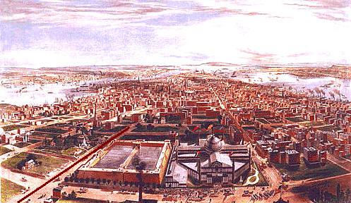
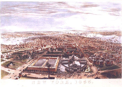
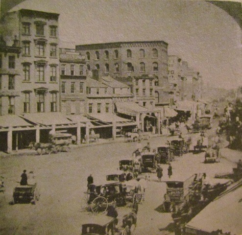
The last post showed the city from 63rd Street to the Battery by putting together two pictures from the 1850s. Here they are again; click here to read the original post. A painted line runs down Fifth Avenue in both pictures, and you can see the dome and flag of the Crystal Palace on 42nd Street in both. The top one is from 1855, the […]
19
May
May
Old landscape drawings and panoramas of the city can be mesmerizing, in addition to being information-rich artifacts of the past. In a time when we record more data about the city in an hour than we did for the first 300 years of history, these images only become more important with time. This post takes […]
12
Mar
Mar
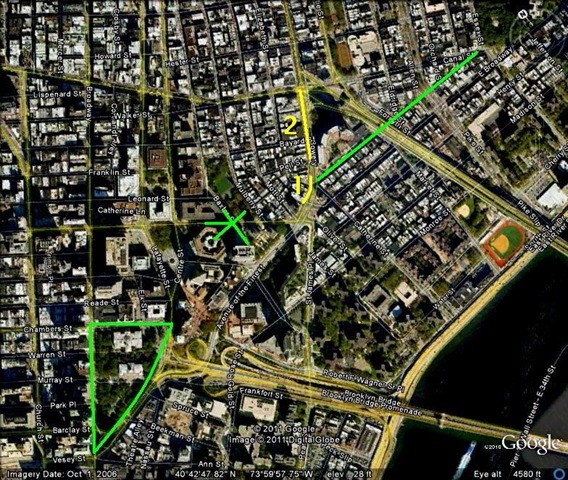
This post builds on The Bowery & Chatham Square, heading up a few blocks to where the Manhattan Bridge intersects Canal Street. The Bull’s Head tavern dominated the immediate area as the unofficial headquarters of the cattle market from the Colonial days of the 1750s up until 1825, when society elites set their sights on […]
06
Mar
Mar
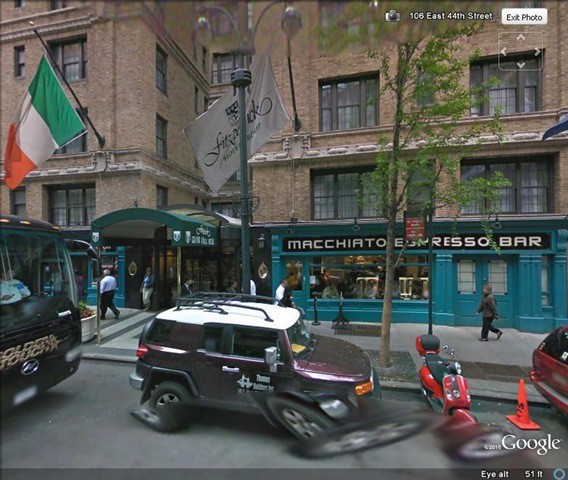
Just a quick, fun post. I was watching Pawn Stars and a guy walked in with a canceled check signed by Carlo Gambino in 1962. It was from S.G.S. Associates, and you could see the address on the check: 141 East 44th Street. I Google Earthed it…The Fitzpatrick Grand Hotel. (Flag of Ireland).
04
Mar
Mar
While preparing Part II of The Story Behind the Lower East Side, I came across some old photographs of Chatham Square and couldn’t resist checking out their locations. Here’s a photograph from Kenneth Dunshee’s As You Pass By. This is a reported funeral procession heading up the Bowery through Chatham Square in 1869. Doyers Street would be […]
02
Mar
Mar
This look at the Lower East Side will be done over three posts. This first post will use old maps to reconstruct the area from Colonial days, and look at how the Lower East Side developed initially, before the days of New York’s iconic immigration. The next post will go to street level, looking at […]
16
Feb
Feb
This is a small tribute to the brave and amazing people of Tahrir Square. To acknowledge and bring awareness of that great, age-old culture, this post will look at Egyptian influences from the past, present (and future!) in Manhattan’s streetscape. The first great architectural wave to sweep the city (and the nation) was the 1830s […]
04
Feb
Feb
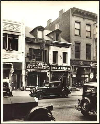
Just a quick post. Going through the Museum of the City of New York’s archives I found this 1932 picture of 298 Grand Street. The Federal-style home below was already 100 years old at the time (they’d stopped building dormer windows around 1840). By 1932, this was in the heart of the Jewish Lower East […]
Broadway, Madison Square, NoMad, Old Posts, Old Roads
The Haymarket, Broadway & NoMad—and a Long Forgotten Street!
28
Jan
Jan
There’s a strange part of town that’s in the middle of everywhere. In the 1990s it was the counterfeit garment district; and not just clothing, but it’s where they made the knock-off Gucci and Louis Vuitton bags until even that “industry” moved overseas. Today the area is a bizarre amalgam of third rate retailers, “wholesalers to the public,” and […]